Maps of Netherlands on atlasandmap.com |
| Title/Maker | Year | Measures | Price | |
|
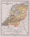 | De Bataafsche Republiek in 1801
by C.L. Brinkman, Amsterdam | 1881 | 14,5 X 19 cm | 16 euro |
|
 | Kaart Nordvestra Tyskland, Nederländerna och Belgien.
by Stieler | 1868 | 24,5 X 18,5 cm | 21 euro |
|
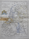 | De Nederlanden 1855
by Veelwaard | 1855 | 15 X 19.5 cm | 21 euro |
|
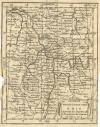 | Les Deux Cercles du Haut et Bas Rhin
by Buffier | 1739 | 14 X 18 cm | 21 euro |
|
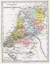 | De republiek der Vereenigde Nederlanden in 1720
by C.L. Brinkman, Amsterdam | 1881 | 14,5 X 19 cm | 26 euro |
|
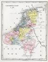 | Nederland in 1560
by C.L. Brinkman, Amsterdam | 1881 | 14,5 X 19 cm | 26 euro |
|
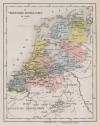 | De Vereenigde Nederlanden in 1648
by C.L. Brinkman, Amsterdam | 1881 | 14,5 X 19 cm | 26 euro |
|
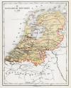 | De Bataafsche Republiek in 1798
by C.L. Brinkman, Amsterdam | 1881 | 14,5 X 19 cm | 26 euro |
|
 | Het Koningrijk Holland in 1810
by C.L. Brinkman, Amsterdam | 1881 | 14,5 X 19 cm | 26 euro |
|
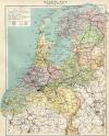 | Nederland (Staatkundig)
by Winkler Prins | 1910 | 22 X 28 cm | 26 euro |
|
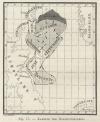 | Kaartje ter Haringvisscherij
by H.J.G. Vrickx | 1881 | 8 X 10 cm | 26 euro |
|
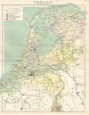 | Nederland (Grondsoorten)
by Winkler Prins | 1910 | 22 X 28 cm | 29 euro |
|
 | Duitschland in ´t jaar 1512; De 10 kreitsen naar de verdeeling van keizer Maximiliaan 1, 1512
by P.W.M. Trap | 1876 | 28 X 22 cm | 32 euro |
|
 | Nederland
by P.W.M. Trap | 1876 | 28 X 22 cm | 32 euro |
|
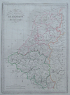 | Carte de Belgique et de Hollande
by Thierry | 1843 | 22 X 30 cm | 42 euro |
|
 | Antillen
by Winkler Prins | 1895ca | 27 X 23 cm | 42 euro |
|
 | Holland
by Arrowsmith, Lowry | 1802 | 25 X 20 cm | 42 euro |
|
 | Populorum Germaniae inter Rhenum et Albim Descript ut inter Coesaris et Traiani imperia Incoluerunt
by P. Clüver | 1700ca | 21 X 16 cm | 47 euro |
|
 | West-Indië
by Kuyper (Kuijper) | 1882 | 20 X 15,5 cm | 52 euro |
|
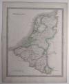 | Netherlands
by J. Dower | 1844 | 34,5 X 41 cm | 63 euro |
|
 | Agri Frisii Antiqvi
by Mensone Alting | 1725 | 41 X 31 cm | 83 euro |
|
 | Descriptio Fresiae Universae... Francorum Saxonum
by Mensone Alting, Gerard de Broen | 1725 | 41 X 31 cm | 104 euro |
|
 | Landkaart van het thans genaamde Holland zoo als dat, in ´t begin der vyfde eeuwe, door
by Pieter de Hondt | 1745 | 38 X 37 cm | 104 euro |
|
 | West Indien, nach den besten und neuesten Quellen entworfen und gezeichnet
by Carl Glaser | 1836 | 42 X 33,5 cm | 104 euro |
|
 | Landskaart verbeeldende de twee Romeynsche heirbaanen of groote weegen in het eyland der Batavieren
by Pieter de Hondt | 1734 | 43,5 X 28,5 cm | 104 euro |
|
 | Landkaart van het Eyland der Batavieren verbeeldende de vier Romeynsche Standplaatsen
by Pieter de Hondt | 1734 | 38,5 X 36,5 cm | 104 euro |
|
 | Descriptio Frisiae sub Francorum reditum
by Gerrit de Broen | 1725 | 42 X 31,5 cm | 104 euro |
|
 | 2e Carte des Sept Provinces Unies des Pais-Bas
by Louis Charles Desnos | 1755 | 61 X 47 cm | 125 euro |
|
 | 1e Carte des Sept Provinces Unies des Pais-Bas
by Louis Charles Desnos | 1755 | 61 X 47 cm | 125 euro |
|
 | Oude kaart der nu Vereenigde Nederlanden tot opheldering der Vaderlandsche historie in de Middeleeuw
by Isaak Tirion | 1749 | 32,5 X 28 cm | 125 euro |
|
 | Trans-Isula D.
by J. Hondius, P. Bertius | 1650ca | 13,5 X 9,5 cm | 156 euro |
|
 | Le Provincie di Frisia, Groninga ed Over-Yssel con parte dell´ Ollanda Propria
by Antonio Zatta | 1778 | 30 X 40 cm | 182 euro |
|
 | Cleve et Murs
by Jodocus Hondius, Gerard Mercator | 1608ca | 18.5 X 14 cm | 187 euro |
|
 | Tabula germaniae emendata recens per Nicolaum Joh. Piscatorem.
by Nicolaas Visscher - Frederik de Wit | 1670 | 55 X 47 cm | 187 euro |
|
 | carta nuova ed Accurata delle XVII Provincie de Paesi Bassi
by Isaac Tirion, G Albrizzi | 1735ca | 28 X 33.5 cm | 187 euro |
|
 | Driehoeks-Meetingen der Bataafsche Republiek
by Onbekend | 1800ca | 38 X 31 cm cm | 207 euro |
|
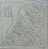 | Cholerae Asiaticae iter per Belgium septentrionale Ao 1832
by Alexander Karel Willem Suerman | 1835 | 25 X 23 cm | 207 euro |
|
 | Naauwkeurige kaart van het Oude Nederland en eenige aangrenzende Gewesten
by I. Tirion | 1750ca | 40 X 28,5 cm | 207 euro |
|
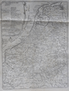 | Les XVII Provinces des Pais Bas
by Le Dauphin, VC, van Loon | 1705 | 21 X 27 cm | 280 euro |
|
 | Belgii veteris typus Ex Conatibus Geographicis Abrahami Ortelii
by Petrus Kaerius | 1741 | 49 X 38 cm | 311 euro |
|
 | Hollandiae Cattorum Regionis Typus
by L. Guicciardini | 1588ca | 32,5 X 24 cm | 363 euro |
|
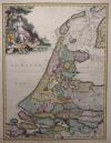 | Holland
by nn | 1725 | 33,5 X 43 cm | 518 euro |
|
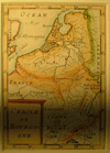 | Cercle de Bourogne
by Mallet | 1730ca | 10 X 15 cm | sold |
|
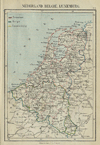 | Nederland, Belgie, Luxemburg
by Kuyper (Kuijper) | 1880 | 10 X 15 cm | sold |
|
 | A Chart of the Northern Ocean between the coasts of England and the United Provinces
by Thomas Kitchin, R. Balwin | 1781 | 34.5 X 29 cm | sold |
|
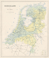 | Kaart van Nederland.
by Puls | 1879 | 37,5 X 31,5 cm | sold |
|
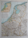 | Niederlande und Belgien
by Richard Andree | 1896 | 38 X 53 cm | sold |
|
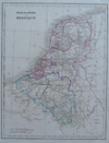 | Hollande et Belgique
by Monin | 1842 | 20 X 26 cm | sold |
|
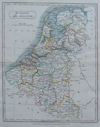 | Holland and Belgium
by Hall | 1839 | 20 X 24 cm | sold |
|
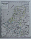 | Niederlande und Belgien
by Justus Perthes | 1861 | 18 X 23 cm | sold |
|
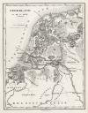 | Nederland in de 1e Eeuw
by C.L. Brinkman, Amsterdam | 1881 | 15 X 19,5 cm | sold |
|
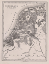 | Nederland in de 7e Eeuw
by C.L. Brinkman, Amsterdam | 1881 | 15 X 19,5 cm | sold |
|
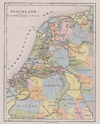 | Nederland. Gouwverdeeling omstreeks de 10e eeuw
by C.L. Brinkman, Amsterdam | 1881 | 15 X 19,5 cm | sold |
|
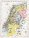 | Nederland in 1350
by C.L. Brinkman, Amsterdam | 1881 | 15 X 19,5 cm | sold |
|
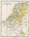 | Het Koningrijk der Nederlanden in 1839
by C.L. Brinkman, Amsterdam | 1881 | 14,5 X 19 cm | sold |
|
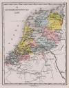 | De Geunieerde Provincien in 1610
by C.L. Brinkman, Amsterdam | 1881 | 14,5 X 19 cm | sold |
|
 | Het Koningrijk Holland in 1806
by C.L. Brinkman, Amsterdam | 1881 | 14,5 X 19 cm | sold |
|
 | De Hollandsche Departementen van het Fransche Keizerrijk 1812.
by C.L. Brinkman, Amsterdam | 1881 | 14,5 X 19 cm | sold |
|
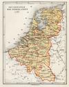 | Het Koningrijk Der Nederlanden in 1815
by C.L. Brinkman, Amsterdam | 1881 | 14,5 X 19 cm | sold |
|
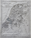 | Nederland in de 1e eeuw
by Veelwaard | 1855 | 15 X 19.5 cm | sold |
|
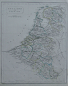 | Holland and Belgium
by F.P. Becker, Virtue | 1848 | 20 X 25 cm | sold |
|
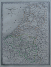 | Pays-Bas et Belgique
by Dufour | 1840 | 20 X 26 cm | sold |
|
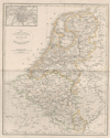 | de Nederlanden, Luxemburg en België
by A. Baedeker | 1844 | 25,5 X 21 cm | sold |
|
 | Duitschland onder de saksiche en frankische Keizers tot 1138
by P.W.M. Trap | 1876 | 28 X 22 cm | sold |
|
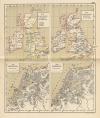 | De Britsche Eilanden; Nederland
by P.W.M. Trap | 1876 | 22 X 28 cm | sold |
|
 | Hoogtekaart van Nederland, Landbouwkaart van Nederland
by F. Bruins | 1884 | 28 X 22 cm | sold |
|
 | Pays Bas Catholiques
by Robert de Vaugondy | 1784 | 15 X 15 cm | sold |
|
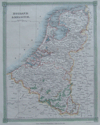 | Holland and Belgium
by Kelly | 1834 | 20 X 25 cm | sold |
|
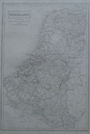 | Netherlands now divided into Holland and Belgium
by A Black, C Black | 1844 | 26 X 38 cm | sold |
|
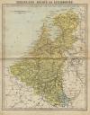 | Nederland, Belgie en Luxemburg
by P.W.M. Trap | 1872 | 23 X 28,5 cm | sold |
|
 | Nederland: Landbouwstelsels, Bijzondere Teelten ... ; Nijverheidskaart van Nederland
by F. Bruins | 1884 | 28 X 22 cm | sold |
|
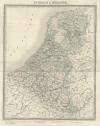 | Belgique et Hollande
by Lemercier | 1860ca | 35 X 43 cm | sold |
|
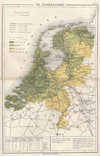 | De Nederlanden
by N.W. Posthumus en Dr. J.M. van Bemmelen | 1881 | 24 X 30 cm | sold |
|
 | The seven united provinces from the best Authorities
by nn | 1760ca | 22 X 19 cm | sold |
|
 | Het Koningryk Der Nederlanden 1815
by De Erven Thierry en Mensing | 1858 | 31,5 X 22 cm | sold |
|
 | Rijn-Maas en Schelde-Delta, het begin der Rijn-Delta, Verhang van de Waal
by F. Bruins | 1884 | 28 X 22 cm | sold |
|
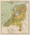 | Nederland (Geologische kaart)
by F. Bruins | 1884 | 22 X 28 cm | sold |
|
 | Nederlandsch West-Indië (Suriname, en Nederlanse Antillen)
by Winkler Prins | 1910 | 27 X 22 cm | sold |
|
 | Nederland op het einde der 13de Eeuw
by De Erven Thierry en Mensing | 1858 | 31,5 X 22 cm | sold |
|
 | Nederland 1530 de laatste tyden der Grafelijke regering
by De Erven Thierry en Mensing | 1858 | 31,5 X 22 cm | sold |
|
 | Nederland 1648. De gevestigde republiek der vereenigde Nederlanden
by De Erven Thierry en Mensing | 1858 | 31,5 X 22 cm | sold |
|
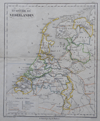 | Het Koningrijk der Nederlanden
by J.B. Wolters | 1860ca | 20 X 25 cm | sold |
|
 | Holland and Belgium
by G.H. Swanston | 1850 ca | 40 X 50 CM cm | sold |
|
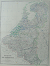 | Belgium and the Netherlands
by Keith Johnston | 1850 ca | 44 X 56 CM cm | sold |
|
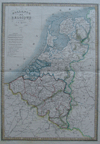 | Hollande et Belgique par C.V. Monin
by C.V. Monin, Hocquart, :aguillermie | 1839 | 28 X 40 cm | sold |
|
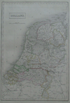 | Holland
by A Black, C Black | 1844 | 26 X 38 cm | sold |
|
 | het Koningrijk der Nederlanden
by A. Baedeker, Rotterdam | 1844 | 26,5 X 21,5 cm | sold |
|
 | Voormalige bezittingen der Nederlanders buiten Europa
by De Erven Thierry en Mensing | 1858 | 31,5 X 22 cm | sold |
|
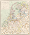 | Kaart van Nederland.
by Puls | 1879 | 35,5 X 30,5 cm | sold |
|
 | Germanie Inferieure - Les Dixsept Provinces - Pays Bas
by Jan van Vianen? | 1715ca | 16.5 X 14.5 cm | sold |
|
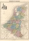 | Hollande et Belgique
by Migeon | 1872 | 41 X 28 cm | sold |
|
 | Blinde kaart
by nn | 1740ca | 28 X 24 cm | sold |
|
 | Gallia Belgica
by Abraham Ortelius | 1601 | 11,5 X 9,5 cm | sold |
|
 | Carte des Provinces-Unies des Pays-Bas
by Robert Vaugondy | 1748 | 19,5 X 16,5 cm | sold |
|
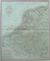 | Royaume des Pays Bas
by Dufour | 1835 | 35 X 42 cm cm | sold |
|
 | Foederatae Belgicae Tabula
by Frederik de Wit | 1670ca | 55 X 45 cm | sold |
|
 | Le XVII provinces del Paesi Bassi
by nn | 1700ca | 18 X 14.5 cm | sold |
|
 | Totius Fluminis RHENI Novissima Descriptio
by Frederik de Wit | 1670 | 53 X 46 cm | sold |
|
 | Nederlandsche Overzeesche Bezittingen met het Koningrijk der Nederlanden in Europa
by L.J.C. Ludolph | 1850ca | 28 X 23,5 cm | sold |
|
 | Les provinces des Pays Bas
by Jan Luijken? | 1697 | 25 X 18.5 cm | sold |
|
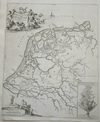 | Frisiae Veteris
by Schotanus | 1725 | 39 X 48 cm cm | sold |
|
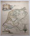 | Typus Frisiae Veteris, inter Rheni medium ostium et Amisiam itemque
by C. Luyken naar de kaart van Schotanus | 1718 | 40,5 X 48,5 cm | sold |
|
 | Carta noua accurata del Passagio et strada dalli Paesi Bassi per via Allemagna per Italia et per via
by Frederik de Wit | 1670 | 56 X 47 cm | sold |
|
 | Belgii veteris typus (ingelijst)
by Petrus Kaerius | 1700 | 47.5 bij 38 cm | sold |
|
 | Novissima et accurattissima xvii provinciarum germaniae inferioris tabula
by Wit, Frederik de | 1670 | 55 X 48 cm | sold |
|
|





 follow us on facebook


 follow us on facebook


