|
last update: Jun-21-2022
Maps of Austria on atlasandmap.com |
| Title/Maker | Year | Measures | Price | |
| ") | Oostenrijk Hongarije (Natuurk. Overzicht)
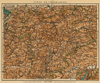
by Winkler Prins | 1910 | 27 X 22 cm | 11 euro | |  | Karintië, Krain, Salzburg, Stiermarken, Tirol en Vorarlberg
by Winkler Prins | 1909 | 28 X 22 cm | 16 euro | |  | Zuid-Duitschland, Zwitserland, Tirol
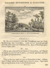
by Kuyper (Kuijper) | 1880 | 20 X 15 cm | 19 euro | | ") | Oostenrijk (Westelijk)
by Kuyper (Kuijper) | 1880 | 20 X 15,5 cm | 19 euro | |  | Neder- en opper Oostenrijk
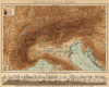
by Winkler Prins | 1910 | 27 X 22 cm | 19 euro | |  | Nieder- und Ober- osterreich, Steiemark, Kärnten, Krain und Küstenland
by W. Berg | 1896 | 38 X 51 cm | 23 euro | |  | Südbayern, Tirol und Salzburg
by G. Jungk. | 1896 | 49 X 40 cm | 23 euro | | ") | Oostenrijk Hongarije (Staatkundig Overzicht)
by Winkler Prins | 1910 | 27 X 22 cm | 23 euro | |  | Het Keizerrijk Oostenrijk
by A. Baedeker, Rotterdam | 1844 | 21 X 27,5 cm | 32 euro | |  | De l´Europe, Cercle de Souabe
by A. Manesson Mallet | 1683 | 12 X 16 cm | 32 euro | |  | Zuid-Europa en Voor-Azie ten tijde van de Kruistochten; Koningrijk Jeruzalem
by P.W.M. Trap | 1876 | 28 X 22 cm | 32 euro | |  | Duitschland in ´t jaar 1512; De 10 kreitsen naar de verdeeling van keizer Maximiliaan 1, 1512
by P.W.M. Trap | 1876 | 28 X 22 cm | 32 euro | |  | Brandenburg, Pruisen en Oostenrijk
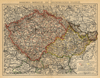
by P.W.M. Trap | 1876 | 28 X 22 cm | 32 euro | |  | Oostenrijk-Hongarije
by F. Bruins | 1884 | 28 X 22 cm | 37 euro | |  | Germania Antiqua
by F Delamarche | 1830 c | 28 X 24 CM cm | 42 euro | |  | Duitsland en Zwitserland
by A. Baedeker | 1844 | 26,5 X 21 cm | 42 euro | |  | Germany
by T. Kitchin | 1770ca | 22,5 X 18 cm | 42 euro | |  | Confédération Germanique, Royaume de Prusse, Empire d´Autriche, Royaume de Pologne
by Félix Delamarche | 1833 | 35 X 26 cm cm | 52 euro | | ") | Empire d´Autriche (Empire Austro - Hongrois)
by Migeon, Sengteller, Desbuissons | 1881 | 39 X 31 cm | 52 euro | |  | Vollständige Post Karte des ERzherzogthums Oesterreich
by Carl Agneton, S. Langer | 1807 | 15 X 11 cm | 104 euro | |  | Ubersichtskarte von osterreich-Ungarn
by A. Thomas, E. Umbreit | 1896 | 46 X 38 cm | sold | |  | Duitschland onder de saksiche en frankische Keizers tot 1138
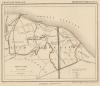
by P.W.M. Trap | 1876 | 28 X 22 cm | sold | |  | Oostenrijk
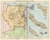
by Emrik & Binger | 1872 | 28,5 X 23 cm | sold | |  | Alpenkaart
by F. Bruins | 1884 | 28 X 22 cm | sold | |  | Austria
by Abraham Ortelius, Philippe Galle | 1595 | 11,5 X 9 cm | sold | |  | Carta noua accurata del Passagio et strada dalli Paesi Bassi per via Allemagna per Italia et per via
by Frederik de Wit | 1670 | 56 X 47 cm | sold | |
Plans of cities in Austria on atlasandmap.com |
| Town | Title/Maker | Year | Measures | Price | |
| Baden
 | Baaden bey Wien (Schloss Weilburg)
by - | 1850 | 15.5 X 10 cm | 26 euro
| | Deutsch-Wagram
 | La chatelaine de Wagram
by Stokolm, Chavane | 1847 | 12 X 16 cm | 26 euro
| | Donau
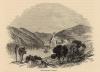
 | Der Donau - Strudel (Nieder - Oesterreich)
by nn | 1850ca | 15 X 10 cm | 26 euro
| | Durenstein
 | Durenstein
by nn | 1850ca | 15 X 10 cm | 26 euro
| | Durnstein:
4 items | Visit our page of the city of Durnstein | Eger
 | Bey Eger in Bohmen
by nn | 1850ca | 15 X 10 cm | 26 euro
| | Engelhardtszell
 | Engelhardtszell an der Donau
by nn | 1850ca | 16 X 13 cm | 32 euro
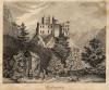
| | Göttweig
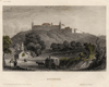 | Gottweih
by nn | 1850ca | 15 X 11,5 cm | 32 euro
| | Gastein
 | Wildbad Gastein
by nn | 1850ca | 10 X 15 cm | 32 euro
| | Gollinger Wasserfall
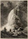 | Der Gollinger Fall in Tyrol
by nn | 1850ca | 10 X 15 cm | 32 euro
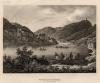
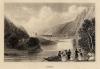
| | Gottweig
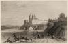
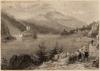
 | Gottweih from the Danube
by W.H. Bartlett, Whimper | 1844 | 12,5 X 6,5 cm | 16 euro
| | Graz:
2 items | Visit our page of the city of Graz | Grein
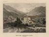
 | Grein
by nn | 1850ca | 16,5 X 12 cm | 26 euro
| | Guttenstein
 | Guttenstein
by C. Reiss | 1850 | 15.5 X 10 cm | 21 euro
| | Hall in Tirol
 | Hals Castle
by W.H. Bartlett | 1844 | 15 X 10,5 cm | 21 euro
| | Hallstatt
 | Hallstadt
by nn | 1850ca | 15 X 10 cm | 32 euro
| | Innsbruck:
5 items | Visit our page of the city of Innsbruck | Innsbruck, Inspruck
 | Inspruck in Tyrol
by nn | 1850ca | 15 X 10 cm | 42 euro
| | Innthale:
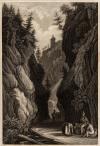
2 items | Visit our page of the city of Innthale | Jochenstein
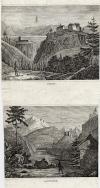
 | The Jochenstein
by Whimper | 1844 | 11,5 X 8 cm | 16 euro
| | Juval, Brunecken
 | Juval, Brunecken
by nn | 1850ca | 10 X 21 cm | 16 euro
| | Kufstein
 | Veste Kufstein in Tyrol
by nn | 1850ca | 16,5 X 13 cm | 26 euro
| | Landeck:
3 items | Visit our page of the city of Landeck | Laxenburg:
5 items | Visit our page of the city of Laxenburg | Linz
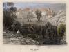
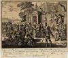 | Den abt eens Kloosters bij Lints eenige boeren het hoofd af latende
by nn | 1698 | 15,5 X 13,5 cm | 47 euro
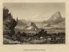
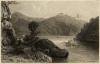
| | Martinsberg
 | Le Martinsberg pres d´Inspruck
by Mercey, Havell, Kernot | 1850ca | 10,5 X 15,5 cm | 26 euro
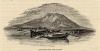
| | Moelk an der Donau
 | Benedictiner - Abtey Moelk an der Donau in Oesterreich
by nn | 1850ca | 15 X 10 cm | 26 euro
| | Neuhaus
 | Schloss Neuhaus an der Donau
by nn | 1850ca | 15 X 10 cm | 32 euro
| | Obermuhl an der Donau
 | Der Obere Michel
by nn | 1840ca | 16,5 X 11,5 cm | 37 euro
| | Salzburg:
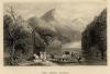
4 items | Visit our page of the city of Salzburg | Sankt Michael im Lungau
 | Scene on the Danube, near St. Michael
by J.W. Whimper | 1844 | 14 X 10,5 cm | 21 euro
| | Sankt Nikola an der Donau:
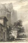
2 items | Visit our page of the city of Sankt Nikola an der Donau | Schonbuhel
 | Schönbuchel castle
by mogelijk W.H. Bartlett | 1844 | 13,5 X 10,5 cm | 21 euro
| | Stixenstein
 | Stuchsenstein
by C.W. Medau, P. Rohrich | 1845 | 20 X 17 cm | 26 euro
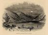
| | Tirol
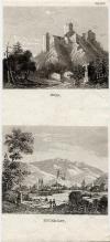
 | Haus des Sandwirth´s Hofer in Tyrol
by nn | 1850ca | 14,5 X 11,5 cm | 42 euro
| | Tirol, Landeck
 | Tirol, Landeck
by nn | 1850ca | 10 X 21 cm | 16 euro
| | Tirol, Tyrol
 | Haus des Sandwirth´s Hofer in Tyrol
by nn | 1850ca | 15 X 10 cm | 32 euro
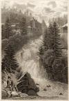
| | Traunfall
 | Der Traunfall
by C. Reiss | 1850ca | 15 X 10 cm | 32 euro
| | Wörth
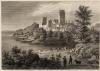
 | Burg Woerth
by nn | 1850ca | 16 X 12,5 cm | 37 euro
| | Wallsee-Sindelburg
 | Schloss Walsee
by nn | 1850ca | 16 X 11,5 cm | 37 euro
| | Weideneck
 | Schloss Weideneck Nieder - Oesterreich
by nn | 1850ca | 15 X 10 cm | 32 euro
| | Wenen, Vienna:
19 items | Visit our page of the city of Wenen, Vienna | Woerth
 | Burg Woerth
by nn | 1850ca | 15 X 10 cm | 32 euro
| |
| |


 follow us on facebook