
Rediscover your world at Atlas and Map
The place for your antique maps, plans, books and prints
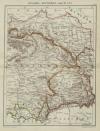
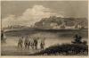
Antique maps of Serbia and Montenegro
The place for your antique maps, plans, books and prints
Antique maps of Serbia and Montenegro
Only orginal maps an printsOn atlasandmap.com you can find only original items for saleYou will get a certificate of authenticity with each map or print:  |
, Servië, Montenegro")


New:
Maps
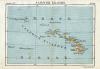
Sandwich Eilanden (Hawaï)
Kuyper maps
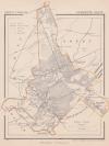
Gemeente Zeist
Prints
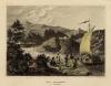
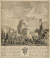
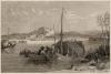
Alexander, Grootvorest, Throonopvolger van Rusland en zijn gemalin Maria Feodorowna

Townplans and views
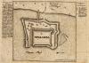
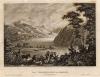
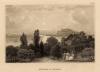
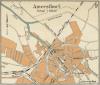
Amersfoort: Amersfoort
Books and atlasses
FACSIMILE: Gemeente-Atlas van de provincie Friesland 1861

We are on facebook now:
 follow us on facebook
for news, highlighted special items and items on your dutch roots.
Maps
Sandwich Eilanden (Hawaï)
Kuyper maps
Gemeente Zeist
Prints
Alexander, Grootvorest, Throonopvolger van Rusland en zijn gemalin Maria Feodorowna
Townplans and views
Amersfoort: Amersfoort
Books and atlasses
FACSIMILE: Gemeente-Atlas van de provincie Friesland 1861
We are on facebook now:
follow us on facebookfor news, highlighted special items and items on your dutch roots.