|
last update: Jun-29-2026
Maps of Greece on atlasandmap.com |
| Title/Maker | Year | Measures | Price | |
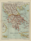
|  | Griekenland
by Winkler Prins | 1908 | 28 X 22 cm | 21 euro | |  | Historische kaart van het Oosters vraagstuk
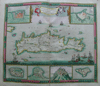
by Winkler Prins | 1910 | 27 X 22 cm | 23 euro | |  | Balkanhalbinsel
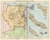
by Richard Andree | 1896 | 37 X 47 cm | 23 euro | |  | Balkan-Schiereiland
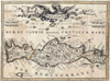
by Winkler Prins | 1905 | 27 X 23 cm | 26 euro | |  | Grece Turquie
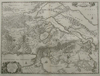
by Poussielgue Frêres | 1870 | 33 X 24 cm cm | 32 euro | |  | Griekenland en zijne volkplantingen; Italie omstreeks 500
by P.W.M. Trap | 1876 | 28 X 22 cm | 32 euro | |  | Oud-Griekenland; Athenae
by P.W.M. Trap | 1876 | 22 X 28 cm | 32 euro | |  | Zuid-Europa en Voor-Azie ten tijde van de Kruistochten; Koningrijk Jeruzalem
by P.W.M. Trap | 1876 | 28 X 22 cm | 32 euro | | ") | Ancient Africa or Libya part 2 (with Crete/Kreta)
by J en C Walker | 1840 | 40 X 31 cm cm | 37 euro | |  | Carte de la Grece anciene et moderne
by A. Faure | 1744 | 18 X 15 cm | 37 euro | |  | Het Balkan-Schiereiland
by F. Bruins | 1884 | 22 X 28 cm | 37 euro | |  | La Phocide, la Doride, et les Pays des Locriens
by A. Tardieu | 1790ca | 21 X 15 cm | 37 euro | |  | Europeiska Turkiet, Grekland och Ioniska Oarne
by Stieler | 1868 | 25 X 21,5 cm | 42 euro | |  | Graeciae Antiquae, Mappa Nova
by Félix Delamarche | 1833 | 43 X 24 cm cm | 52 euro | |  | Griekenland en de Griekse Koloniën
by De erven Thierry en Mensing | 1858 | 31,5 X 22 cm | 52 euro | |  | La Turquie en Europe sur les observations de l´Academie des Sciences de Paris
by A. Faure | 1744 | 18 X 14 cm | 52 euro | |  | Turquie D´Europe
by Migeon, Sengteller, Desbuissons | 1881 | 28 X 40 cm | 52 euro | |  | Grèce Moderne
by Migeon, Sengteller, Desbuissons | 1881 | 37 X 30 cm | 52 euro | |  | Hongarije, Transsylvanië, Bulgarije, Macedonië
by Sebastian Munster | 1575ca | 19 X 15,5 cm | 156 euro | |  | Asia intra Maeotim Pontum et mare Caspium
by Weigel | 1720 | 38 X 31 cm | sold | |  | Griechenland
by Richard Andree | 1896 | 37 X 25 cm | sold | |  | Oud-Griekenland
by Winkler Prins | 1908 | 28 X 22 cm | sold | |  | Graecia
by De Erven Thierry en Mensing | 1858 | 31,5 X 22 cm | sold | |  | Europeesch-Turkije en Griekenland
by Emrik & Binger | 1872 | 23 X 28,5 cm | sold | |  | Turquie d´Europe
by Félix Delamarche | 1832 | 30 X 26 cm cm | sold | |  namtellus Gracia maior") | Itala (Italia) namtellus Gracia maior
by Joannes Jansonius | 1750ca | 52 X 38 cm | sold | |  | Europisch Turkije en Griekenland
by A. Baedeker | 1850 | 26,5 X 21,5 cm | sold | |  | Aeneae Troiani navigatio
by Ook Italië | 1700 | 49 X 39 cm | sold | |  | Hellas seu Graecia universa
by Laurenberg, S | 1690ca | 56 X 46.5 cm | sold | |  | Hellas seu Graecia Sophiani
by Papierformaat is 66 X 54 cm\r\nKoeman: Ja-10-26 | 1700 | 49 X 36 cm | sold | |
Plans of cities in Greece on atlasandmap.com |
| Town | Title/Maker | Year | Measures | Price | |
| Athen, Athens, Athina:
2 items | Visit our page of the city of Athen, Athens, Athina | Athene:
7 items | Visit our page of the city of Athene | Athene, Athens
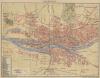
 | Athene
by Winkler Prins | 1895ca | 27 X 23 cm | 21 euro
| | Corfu
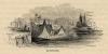
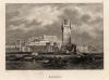
 | Corfu
by nn | 1850ca | 16,5 X 11,5 cm | 32 euro
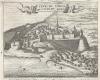
| | Corinth, Korinth, Korinthos
 | Corinth
by nn | 1850ca | 15 X 10 cm | 52 euro
| | Delphi
 | Delphi
by nn | 1850ca | 10 X 15 cm | 21 euro
| | Euboea, Evia, Negroponte
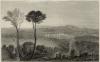 | Negroponte
by nn | 1850ca | 10 X 15 cm | 42 euro
| | Ithaka, Ithaca
 | Ithaca
by nn | 1850ca | 15 X 10 cm | 42 euro
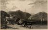
| | Koroni
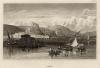
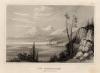
 | Veue de Coron du cote du Golfe
by nn | 1688 | 16,5 X 13 cm | 83 euro
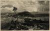
| | Kreta
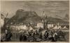
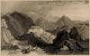
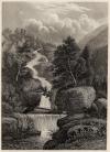 | Die Silber-cascade, Weisse Berge
by nn | 1850ca | 12,5 X 17 cm | 32 euro
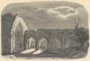
| | Lazaretto
 | Lazaretto
by W.H. Bartlett | 1844 | 9,5 X 5 cm | 16 euro
| | Lefkada, Santa Maura
 | Sta Maura und die Griechische Kuste
by nn | 1850ca | 15 X 10 cm | 52 euro
| | Mytilene
 | Mytilene
by L. Deifel | 1836 | 15 X 11 cm | 52 euro
| | Olympus
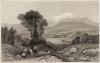 | Olympus
by nn | 1850ca | 15 X 10 cm | 32 euro
| | Pyrgos
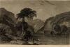
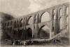 | Aqueduct of the Greek emperors, near Pyrgo
by W.H. Bartlett, R. Wallis | 1854 | 18,5 X 12,5 cm | 42 euro
| | Rhodos
 | Rhodes
by Aubert | 1840ca | 15 X 11,5 cm | 26 euro
| | Rhodos, Rhodes
 | Maison des chevaliers de Rhodes (Asie Mineure)
by E. Breton | 1843 | 16 X 11 cm | 26 euro
| | Salamis
 | Salamis
by nn | 1850ca | 15 X 10 cm | 21 euro
| | Suli
 | Suli
by nn | 1850ca | 15 X 10 cm | 32 euro
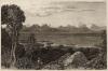
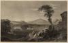
| | Tempe Valley
 | La Valle Tempe en Grece, Das Tempe - Thal in Griechenland, Tempe
by nn | 1850ca | 15 X 10 cm | 16 euro
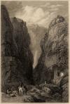
| | Thermopylae
 | Die Thermopylen (Griechenland)
by nn | 1850ca | 16,5 X 12,5 cm | 26 euro
| |
| |


 follow us on facebook