
Rediscover your world at Atlas and Map
The place for your antique maps, plans, books and prints
Historische kaarten van Europa IV (Europe)
The place for your antique maps, plans, books and prints
Historische kaarten van Europa IV (Europe)
Only orginal maps an printsOn atlasandmap.com you can find only original items for saleYou will get a certificate of authenticity with each map or print:  |
| HOME - MAPS - PRINTS - BOOKS - INFO | ||||||||||||||||||
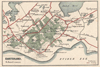
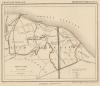
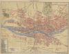
Antique map Historische kaarten van Europa IV (Europe) | ||||||||||||||||||
| ||||||||||||||||||
| HOME - MAPS - PRINTS - BOOKS - INFO | ||||||||||||||||||

New:
Maps
Gaasterland
Kuyper maps
Gemeente Wemeldingen
Prints
Bookplate of the Bastille

Townplans and views
Bremen: Bremen
Books and atlasses
FACSIMILE: Gemeente-Atlas van Nederland deel 8 Overijssel

We are on facebook now:
 follow us on facebook
for news, highlighted special items and items on your dutch roots.
Looking for an antique map, historical print or plan? Feel welcome and browse our mapsite atlasandmap.com!
We have maps, made by Winkler Prins . more maps of Europe like Historische kaarten van Europa IVPlease contact us if you don't find where you are looking for! We ship worldwide.
Maps
Gaasterland
Kuyper maps
Gemeente Wemeldingen
Prints
Bookplate of the Bastille
Townplans and views
Bremen: Bremen
Books and atlasses
FACSIMILE: Gemeente-Atlas van Nederland deel 8 Overijssel
We are on facebook now:
follow us on facebookfor news, highlighted special items and items on your dutch roots.