Rediscover your world at Atlas and Map
The place for your antique maps, plans, books and prints
Antique maps of Israel


HOME - MAPS - PRINTS - BOOKS - INFO
Antique maps of Israel
last update: Jun-17-2022
Maps of Israel on atlasandmap.com
Title/MakerYearMeasuresPrice
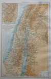
thmbnail of PalestinaPalestina
by Richard Andree
189623 X 38 cm23 euro
thmbnail of West Azië IWest Azië I
by Winkler Prins
190527 X 23 cm26 euro
thmbnail of Zuid-Europa en Voor-Azie ten tijde van de Kruistochten; Koningrijk JeruzalemZuid-Europa en Voor-Azie ten tijde van de Kruistochten; Koningrijk Jeruzalem
by P.W.M. Trap
187628 X 22 cm32 euro
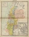
thmbnail of PalestinaPalestina
by P.W.M. Trap
187223 X 28,5 cm42 euro
thmbnail of Tabula Geographica Terrae Sanctae ; Kaart van het Heilige LandTabula Geographica Terrae Sanctae ; Kaart van het Heilige Land
by Jacob Bonfrerius
171770 X 25 cm259 euro
thmbnail of Nieuwe kaart van Irak Arabi, Kurdistan, Diarbek, Turkomannia, Syrië en het Heilige LandNieuwe kaart van Irak Arabi, Kurdistan, Diarbek, Turkomannia, Syrië en het Heilige Land
by Isaak Tirion
1745ca35 X 28,5 cm311 euro
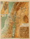
thmbnail of PalestinaPalestina
by Winkler Prins
191022 X 28 cmsold
information about map on atlasandmap.com
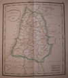
thmbnail of Duodecim Tribus IsraelisDuodecim Tribus Israelis
by Félix Delamarche
183223 X 26 cm cmsold
information about map on atlasandmap.com
thmbnail of Terra Sancta, sive Promissionis, olim Palestina recens delineata, et in lucem Terra Sancta, sive Promissionis, olim Palestina recens delineata, et in lucem
by Wit, Frederik de
167055.5 X 46 cmsold
information about map on atlasandmap.com
thmbnail of Premiere Partie de la Carte d´Asie Contenant la Turquie, l´Arabie, la Perse, l´IndPremiere Partie de la Carte d´Asie Contenant la Turquie, l´Arabie, la Perse, l´Ind
by d Anville, de la Haye
175177 X 73 cmsold
information about map on atlasandmap.com

Maps of regions in Israel on atlasandmap.com
RegionTitle/MakerYearMeasuresPrice

Carte de la dispersion des Peuples Apres le Deluge
by FĂ©lix Delamarche
183239 X 26 cm cm32 euro

Aziatisch Turkije
by Kuyper (Kuijper)
188220 X 15,5 cm19 euro

Plans of cities in Israel on atlasandmap.com
TownTitle/MakerYearMeasuresPrice

Cave of the school of the Prophets
by W.H. Bartlett, J. Sands
183820 X 12,5 cm32 euro
Absalon
Das Absalonsche Mausoleum
by nn
1850ca15 X 10 cm32 euro
Akko, Acre
St Jean d´Acre
by J. Schroeder
1850ca15 X 10 cm47 euro
Carmel
Aussicht vom Berge Carmel
by nn
1850ca15 X 11 cm32 euro
Dode Zee, Dead Sea
Plain of the Jordan, Looking towards the Dead Sea
by T. Allom, S. Fisher
183619 X 13 cm47 euro
Jerusalem:
4 items
Visit our page of the city of Jerusalem
Jeruzalem, Jerusalem:
17 items
Visit our page of the city of Jeruzalem, Jerusalem
Karmel, Carmel
Mount Carmel, looking towards the sea
by W.H. Bartlett, W. Floyd
183820 X 13 cm37 euro
Meer van Tiberias, Lake of Tiberias
Lake of Tiberias, or sea of Galilee
by T. Allom, W. Floyd
183819,5 X 13 cm47 euro
Nazareth:
2 items
Visit our page of the city of Nazareth
Ramla
Ramla
by E. Aubert
1850ca14,5 X 10 cm37 euro
Tabor
Der Berg Tabor
by nn
1850ca15 X 11 cm32 euro
TIberias
Tiberias (Palastina)
by A. Geyer, W. French
1840ca17 X 12,5 cm32 euro

HOME - MAPS - PRINTS - BOOKS - INFO
New:
Maps
Kaarten voor de geschiedenis der aardrijkskunde II (2)

Kuyper maps
Gemeente Gouda

Prints
Reinoud IIe agttiende heer van Brederode, door de Utrechtsche Bisschop, David van Bourgondien...

Townplans and views
Roermond: Ruremunda Gelriea opp.

Books and atlasses
FACSIMILE: Gemeente-Atlas van de provincie Friesland 1861

We are on facebook now:
follow us on facebook
for news, highlighted special items and items on your dutch roots.


sitemap | recent added | inspired by: kruisbestuiving: benut kennis optimaal - www.kuisbestuiving.nl | contact | RSS | | privacy