
Rediscover your world at Atlas and Map
The place for your antique maps, plans, books and prints
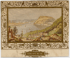
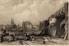
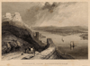
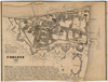
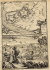
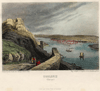
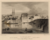
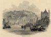
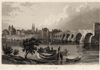
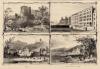
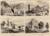
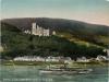
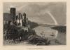
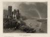
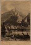
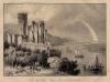
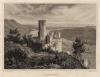
Antique maps plans and views of Koblenz in Germany
The place for your antique maps, plans, books and prints
Antique maps plans and views of Koblenz in Germany
Only orginal maps an printsOn atlasandmap.com you can find only original items for saleYou will get a certificate of authenticity with each map or print:  |
| HOME - MAPS - PRINTS - BOOKS - INFO | ||||||||||||||||||||||||||||||||||||||||||||||||||||||||||||||||||||||||||||||||||||||||||||||||||||||||||||||||||||||||||||||||||||||||||||||||||||||||||||||||||||||||||||||||||||||||||||||||||||||||||||||||||||||||||||||||||||||||||||||||||||||||||||||||||||||||||||||||||||||||||||||||||||||||||||||||||||||||||||||||||||||||||||||||||||||||||||||
Antique maps plans and views of Koblenz in Germany | ||||||||||||||||||||||||||||||||||||||||||||||||||||||||||||||||||||||||||||||||||||||||||||||||||||||||||||||||||||||||||||||||||||||||||||||||||||||||||||||||||||||||||||||||||||||||||||||||||||||||||||||||||||||||||||||||||||||||||||||||||||||||||||||||||||||||||||||||||||||||||||||||||||||||||||||||||||||||||||||||||||||||||||||||||||||||||||||
| ||||||||||||||||||||||||||||||||||||||||||||||||||||||||||||||||||||||||||||||||||||||||||||||||||||||||||||||||||||||||||||||||||||||||||||||||||||||||||||||||||||||||||||||||||||||||||||||||||||||||||||||||||||||||||||||||||||||||||||||||||||||||||||||||||||||||||||||||||||||||||||||||||||||||||||||||||||||||||||||||||||||||||||||||||||||||||||||
| HOME - MAPS - PRINTS - BOOKS - INFO | ||||||||||||||||||||||||||||||||||||||||||||||||||||||||||||||||||||||||||||||||||||||||||||||||||||||||||||||||||||||||||||||||||||||||||||||||||||||||||||||||||||||||||||||||||||||||||||||||||||||||||||||||||||||||||||||||||||||||||||||||||||||||||||||||||||||||||||||||||||||||||||||||||||||||||||||||||||||||||||||||||||||||||||||||||||||||||||||
New:
Maps
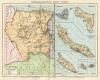
Nederlandsch West-Indië (Suriname, en Nederlanse Antillen)
Kuyper maps
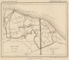
Gemeente Wemeldingen
Prints
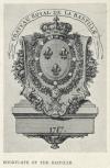
Bookplate of the Bastille
Townplans and views
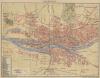
Bremen: Bremen
Books and atlasses
FACSIMILE: Gemeente-Atlas van Nederland deel 8 Overijssel

We are on facebook now:
 follow us on facebook
for news, highlighted special items and items on your dutch roots.
Maps
Nederlandsch West-Indië (Suriname, en Nederlanse Antillen)
Kuyper maps
Gemeente Wemeldingen
Prints
Bookplate of the Bastille
Townplans and views
Bremen: Bremen
Books and atlasses
FACSIMILE: Gemeente-Atlas van Nederland deel 8 Overijssel
We are on facebook now:
follow us on facebookfor news, highlighted special items and items on your dutch roots.