
Rediscover your world at Atlas and Map
The place for your antique maps, plans, books and prints
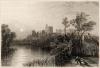
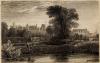
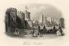
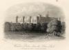
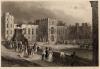
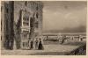
Antique maps plans and views of Windsor in England
The place for your antique maps, plans, books and prints
Antique maps plans and views of Windsor in England
Only orginal maps an printsOn atlasandmap.com you can find only original items for saleYou will get a certificate of authenticity with each map or print:  |
| HOME - MAPS - PRINTS - BOOKS - INFO | |||||||||||||||||||||||||||||||||||||||||||||||||||||||||||||||||||||||||||||||||||||||||||||||||||||||||||||||||||||||||||||||||||||||||||||||||||||||||||||||||||||||||||||||||||||||||
Antique maps plans and views of Windsor in England | |||||||||||||||||||||||||||||||||||||||||||||||||||||||||||||||||||||||||||||||||||||||||||||||||||||||||||||||||||||||||||||||||||||||||||||||||||||||||||||||||||||||||||||||||||||||||
| |||||||||||||||||||||||||||||||||||||||||||||||||||||||||||||||||||||||||||||||||||||||||||||||||||||||||||||||||||||||||||||||||||||||||||||||||||||||||||||||||||||||||||||||||||||||||
| HOME - MAPS - PRINTS - BOOKS - INFO | |||||||||||||||||||||||||||||||||||||||||||||||||||||||||||||||||||||||||||||||||||||||||||||||||||||||||||||||||||||||||||||||||||||||||||||||||||||||||||||||||||||||||||||||||||||||||
New:
Maps
Groningae et Omlandiae Dominium vulgo De Provincie van Stadt en Lande
Kuyper maps
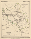
Gemeente Zuidhorn
Prints
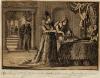
Vermomd als juwelier brengt Gustaaf Adolf zijn eerste bezoek aan zijn verloofde Maria Eleonora van B
Townplans and views
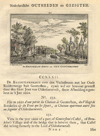
Breukelen: De Breukelse Brug en Out Gunterstein
Books and atlasses
FACSIMILE: Gemeente-Atlas van Nederland deel 8 Overijssel

We are on facebook now:
 follow us on facebook
for news, highlighted special items and items on your dutch roots.
Maps
Groningae et Omlandiae Dominium vulgo De Provincie van Stadt en Lande
Kuyper maps
Gemeente Zuidhorn
Prints
Vermomd als juwelier brengt Gustaaf Adolf zijn eerste bezoek aan zijn verloofde Maria Eleonora van B
Townplans and views
Breukelen: De Breukelse Brug en Out Gunterstein
Books and atlasses
FACSIMILE: Gemeente-Atlas van Nederland deel 8 Overijssel
We are on facebook now:
follow us on facebookfor news, highlighted special items and items on your dutch roots.