
Rediscover your world at Atlas and Map
The place for your antique maps, plans, books and prints
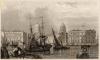
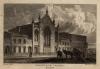
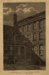
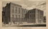
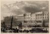
Antique maps plans and views of Londen, London in England,
The place for your antique maps, plans, books and prints
Antique maps plans and views of Londen, London in England,
Only orginal maps an printsOn atlasandmap.com you can find only original items for saleYou will get a certificate of authenticity with each map or print:  |
| HOME - MAPS - PRINTS - BOOKS - INFO | ||||||||||||||||||||||||||||||||||||||||||||||||||||||||||||||||||||||||||||||||||||||||||||||||||||||||||||||||||||||||||||||||||||||||||||||||||||||||||||||||||||||||||
Antique maps plans and views of Londen, London in England, | ||||||||||||||||||||||||||||||||||||||||||||||||||||||||||||||||||||||||||||||||||||||||||||||||||||||||||||||||||||||||||||||||||||||||||||||||||||||||||||||||||||||||||
| ||||||||||||||||||||||||||||||||||||||||||||||||||||||||||||||||||||||||||||||||||||||||||||||||||||||||||||||||||||||||||||||||||||||||||||||||||||||||||||||||||||||||||
| HOME - MAPS - PRINTS - BOOKS - INFO | ||||||||||||||||||||||||||||||||||||||||||||||||||||||||||||||||||||||||||||||||||||||||||||||||||||||||||||||||||||||||||||||||||||||||||||||||||||||||||||||||||||||||||


New:
Maps
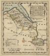
An improved map of Flint Shire containing the Borough and Market Towns
Kuyper maps
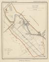
Gemeente Zuilen
Prints
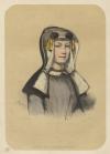
Noord-Hollandsch Meisje
Townplans and views
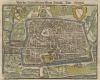
Utrecht: Von der Bisschofflichen Statt Utrecht
Books and atlasses
FACSIMILE: Gemeente-Atlas van de provincie Friesland 1861

We are on facebook now:
 follow us on facebook
for news, highlighted special items and items on your dutch roots.
Maps
An improved map of Flint Shire containing the Borough and Market Towns
Kuyper maps
Gemeente Zuilen
Prints
Noord-Hollandsch Meisje
Townplans and views
Utrecht: Von der Bisschofflichen Statt Utrecht
Books and atlasses
FACSIMILE: Gemeente-Atlas van de provincie Friesland 1861
We are on facebook now:
follow us on facebookfor news, highlighted special items and items on your dutch roots.