|
On this page you can find maps of Netherlands
For maps of regions (provincies) click on the region below:
Drenthe -- Friesland -- Gelderland -- Groningen -- Limburg -- Noord-Brabant -- Noord-Holland -- Overijssel -- Utrecht -- Zeeland -- Zuid-Holland
last update: May-14-2026 |
Maps of Netherlands on Atlas and Map |
| Title/Maker | Year | Measures | Price | |
|  | De republiek der Vereenigde Nederlanden in 1720
by C.L. Brinkman, Amsterdam | 1881 | 14,5 X 19 cm | 26 euro | |  | Nederland in 1560
by C.L. Brinkman, Amsterdam | 1881 | 14,5 X 19 cm | 26 euro | |  | De Vereenigde Nederlanden in 1648
by C.L. Brinkman, Amsterdam | 1881 | 14,5 X 19 cm | 26 euro | |  | Het Koningrijk Holland in 1810
by C.L. Brinkman, Amsterdam | 1881 | 14,5 X 19 cm | 26 euro | |  | Carte de Belgique et de Hollande
by Thierry | 1843 | 22 X 30 cm | 42 euro | |  | Cleve et Murs
by Jodocus Hondius, Gerard Mercator | 1608ca | 18.5 X 14 cm | 187 euro | |  | Driehoeks-Meetingen der Bataafsche Republiek
by Onbekend | 1800ca | 38 X 31 cm cm | 207 euro | |  | Cholerae Asiaticae iter per Belgium septentrionale Ao 1832
by Alexander Karel Willem Suerman | 1835 | 25 X 23 cm | 207 euro | |  | Belgii veteris typus Ex Conatibus Geographicis Abrahami Ortelii
by Petrus Kaerius | 1741 | 49 X 38 cm | 311 euro | |  | Cercle de Bourogne
by Mallet | 1730ca | 10 X 15 cm | sold | |  | De Bataafsche Republiek in 1801
by C.L. Brinkman, Amsterdam | 1881 | 14,5 X 19 cm | sold | |  | A Chart of the Northern Ocean between the coasts of England and the United Provinces
by Thomas Kitchin, R. Balwin | 1781 | 34.5 X 29 cm | sold | |  | Kaart van Nederland.
by Puls | 1879 | 37,5 X 31,5 cm | sold | |  | Hollande et Belgique
by Monin | 1842 | 20 X 26 cm | sold | |  | Holland and Belgium
by Hall | 1839 | 20 X 24 cm | sold | |  | Niederlande und Belgien
by Justus Perthes | 1861 | 18 X 23 cm | sold | |  | Nederland in de 1e Eeuw
by C.L. Brinkman, Amsterdam | 1881 | 15 X 19,5 cm | sold | |  | Nederland in de 7e Eeuw
by C.L. Brinkman, Amsterdam | 1881 | 15 X 19,5 cm | sold | |  | Nederland. Gouwverdeeling omstreeks de 10e eeuw
by C.L. Brinkman, Amsterdam | 1881 | 15 X 19,5 cm | sold | |  | Nederland in 1350
by C.L. Brinkman, Amsterdam | 1881 | 15 X 19,5 cm | sold | |  | Het Koningrijk der Nederlanden in 1839
by C.L. Brinkman, Amsterdam | 1881 | 14,5 X 19 cm | sold | |  | De Geunieerde Provincien in 1610
by C.L. Brinkman, Amsterdam | 1881 | 14,5 X 19 cm | sold | |  | De Bataafsche Republiek in 1798
by C.L. Brinkman, Amsterdam | 1881 | 14,5 X 19 cm | sold | |  | Het Koningrijk Holland in 1806
by C.L. Brinkman, Amsterdam | 1881 | 14,5 X 19 cm | sold | |  | De Hollandsche Departementen van het Fransche Keizerrijk 1812.
by C.L. Brinkman, Amsterdam | 1881 | 14,5 X 19 cm | sold | |  | Het Koningrijk Der Nederlanden in 1815
by C.L. Brinkman, Amsterdam | 1881 | 14,5 X 19 cm | sold | |  | Holland and Belgium
by F.P. Becker, Virtue | 1848 | 20 X 25 cm | sold | |  | Pays-Bas et Belgique
by Dufour | 1840 | 20 X 26 cm | sold | |  | de Nederlanden, Luxemburg en België
by A. Baedeker | 1844 | 25,5 X 21 cm | sold | |  | Holland and Belgium
by Kelly | 1834 | 20 X 25 cm | sold | |  | Netherlands now divided into Holland and Belgium
by A Black, C Black | 1844 | 26 X 38 cm | sold | |  | De Nederlanden
by N.W. Posthumus en Dr. J.M. van Bemmelen | 1881 | 24 X 30 cm | sold | |  | The seven united provinces from the best Authorities
by nn | 1760ca | 22 X 19 cm | sold | |  | Het Koningryk Der Nederlanden 1815
by De Erven Thierry en Mensing | 1858 | 31,5 X 22 cm | sold | |  | Nederland op het einde der 13de Eeuw
by De Erven Thierry en Mensing | 1858 | 31,5 X 22 cm | sold | |  | Nederland 1530 de laatste tyden der Grafelijke regering
by De Erven Thierry en Mensing | 1858 | 31,5 X 22 cm | sold | |  | Nederland 1648. De gevestigde republiek der vereenigde Nederlanden
by De Erven Thierry en Mensing | 1858 | 31,5 X 22 cm | sold | |  | Holland and Belgium
by G.H. Swanston | 1850 ca | 40 X 50 CM cm | sold | |  | Belgium and the Netherlands
by Keith Johnston | 1850 ca | 44 X 56 CM cm | sold | |  | Hollande et Belgique par C.V. Monin
by C.V. Monin, Hocquart, :aguillermie | 1839 | 28 X 40 cm | sold | |  | Holland
by A Black, C Black | 1844 | 26 X 38 cm | sold | |  | het Koningrijk der Nederlanden
by A. Baedeker, Rotterdam | 1844 | 26,5 X 21,5 cm | sold | |  | Voormalige bezittingen der Nederlanders buiten Europa
by De Erven Thierry en Mensing | 1858 | 31,5 X 22 cm | sold | |  | Kaart van Nederland.
by Puls | 1879 | 35,5 X 30,5 cm | sold | |  | Hollande et Belgique
by Migeon | 1872 | 41 X 28 cm | sold | |  | Royaume des Pays Bas
by Dufour | 1835 | 35 X 42 cm cm | sold | |  | Foederatae Belgicae Tabula
by Frederik de Wit | 1670ca | 55 X 45 cm | sold | |  | Le XVII provinces del Paesi Bassi
by nn | 1700ca | 18 X 14.5 cm | sold | |  | Les provinces des Pays Bas
by Jan Luijken? | 1697 | 25 X 18.5 cm | sold | |  | Frisiae Veteris
by Schotanus | 1725 | 39 X 48 cm cm | sold | |
Plans and views on Atlas and Map |
| Town | Title/Maker | Year | Measures | Price | |
|
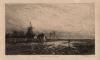
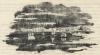 | Luchtspiegeling
by nn | 1835 | 13 X 7,5 cm | 11 euro
| |
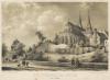
 | Een kasteel uit de veertiende eeuw
by E. Vermorcken | 1865ca | 8,5 X 6 cm | 16 euro
| | Holland
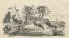 | De Lente
by nn | 1835ca | 14 X 7,5 cm | 16 euro
| |
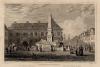
 | Standbeeld op marktplein
by nn | 1900ca | 9 X 6 cm | 21 euro
| |
 | Een Stedewal van Buiten, 18e eeuw
by J. Hilverdink | 1880ca | 21,5 X 15 cm | 26 euro
| | Mainz
 | Fountain at Mayence
by Tombleson, Howard | 1840ca | 16,5 X 12 cm | 26 euro
| | Holland
 | Motiv aus Holland
by H. Charlemont | ca 1880 | 19 X 11 cm cm | 32 euro
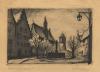
| | Neurenberg, Nuremberg
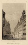 | Hotel de Ville de Nuremberg
by Lemaitre | 1842 | 10 X 15 cm | 32 euro
| | Zevenaar
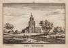 | Out Seventer
by A. Rademaker | 1750 | 11,5 X 8 cm | 32 euro
| |
 | Hollands stadsgezicht
by F.H. Weissenbruch naar Cornelis Springer | 1875ca | 15 X 19 cm | 47 euro
| | Arnhem
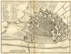 | Grondteekening der Stad Arnhem
by H. de Leth | 1740ca | 22 X 16,5 cm | 125 euro
| | Leeuwarden
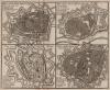 | Plan van de stad Leeuwaarden, Deventer, Groeningen en Zwol
by Hendrik de Leth | 1740 | 21.5 X 18 cm | 156 euro
| | Harlingen
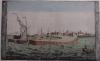 | Haven van Harlingen, van de Zuiderzee te zien
by Matthias de Sallieth | 1781 | 40 X 27 cm | 311 euro
| | Gennep
 | Haus Gennep
by Merian | ca 1660 | 13 X 17 cm cm | sold
| | Renesse
 | Het slot Moermond bij Renesse
by nn, mogelijk J. van Genk naar H. van Geelen | 1840ca | 10,5 X 9,5 cm | sold
| | Wageningen
 | Wagening
by Merian | ca 1660 | 17 X 16 cm cm | sold
| |
|
| |


 follow us on facebook