Rediscover your world at Atlas and Map
The place for your antique maps, plans, books and prints
Maps of Asia


HOME - MAPS - PRINTS - BOOKS - INFO
Antique maps of Asia

Title/MakerYearMeasuresPrice
thmbnail of Azië (Index)Azië (Index)
by Kuyper (Kuijper)
188220 X 15,5 cm19 euro
thmbnail of Natuurkundige kaart van AziëNatuurkundige kaart van Azië
by Winkler Prins
190527 X 23 cm21 euro
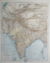
thmbnail of Zentralasien und VorderindienZentralasien und Vorderindien
by Richard Andree
189636 X 49 cm23 euro
thmbnail of Staatkundige overzichtskaart van AziëStaatkundige overzichtskaart van Azië
by Winkler Prins
190527 X 23 cm26 euro
thmbnail of Asien, öfversigt af Landets naturliga Beskaffenhet.Asien, öfversigt af Landets naturliga Beskaffenhet.
by Stieler.
186826,3 x 20,4 cm32 euro
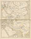
thmbnail of De Rijken der Mongolen, Voor-Azie omstreeks het jaar 1517De Rijken der Mongolen, Voor-Azie omstreeks het jaar 1517
by P.W.M. Trap
187622 X 28 cm32 euro
thmbnail of Azie (Natuurlijke gesteldheid)Azie (Natuurlijke gesteldheid)
by F. Bruins
188428 X 22 cm37 euro
thmbnail of Azie (Bevolkingskaart)Azie (Bevolkingskaart)
by F. Bruins
188428 X 22 cm37 euro
thmbnail of AziëAzië
by P.W.M. Trap
187228,5 X 23 cm42 euro
thmbnail of Sydvestra-Asien och Nil-landetSydvestra-Asien och Nil-landet
by Stieler
186828 X 22 cm63 euro
thmbnail of Asien, Politisk OfversigtAsien, Politisk Ofversigt
by Stieler
186826 X 21,5 cm63 euro
thmbnail of OstIndienOstIndien
by Stieler
186828 X 22 cm73 euro
thmbnail of AsieAsie
by Migeon, Sengteller, Desbuissons
188137 X 31 cm83 euro
thmbnail of AziëAzië
by A. Baedeker
1850ca26 X 21 cm125 euro
thmbnail of Asie Divisee en ses Principaux Etats, Empires & RoyaumesAsie Divisee en ses Principaux Etats, Empires & Royaumes
by Robert de Vaugondy, C. F. Delamarche
179165 X 50 cm363 euro
thmbnail of L’AsieL’Asie
by Félix Delamarche
183335 X 26 cm cmsold
information about map on atlasandmap.com
thmbnail of übersichtskarte von Asienübersichtskarte von Asien
by Richard Andree
189647 X 38 cmsold
information about map on atlasandmap.com
thmbnail of AsienAsien
by nn
1900ca32 X 24 cmsold
information about map on atlasandmap.com
thmbnail of Azie (Staatkundige kaart)Azie (Staatkundige kaart)
by F. Bruins
188428 X 22 cmsold
information about map on atlasandmap.com
thmbnail of West-Azie en de NijllandenWest-Azie en de Nijllanden
by F. Bruins
188428 X 22 cmsold
information about map on atlasandmap.com
thmbnail of AziëAzië
by A. Baedeker
184425,5 X 21,5 cmsold
information about map on atlasandmap.com
thmbnail of AsiaAsia
by nn
1750ca20 X 14 cmsold
information about map on atlasandmap.com

Countries in Asia

We have maps of most countries in Asia. Click on a country for the available maps, townplans and townviews
Afghanistan
Armenia
Azerbaijan
Bahrain
Bangladesh
Bhutan
Brunei
Myanmar
Cambodia
China
Georgia
Hong Kong
India
Iran
Iraq
Israel
Jordan
Kazakhstan
Korea, North
Korea, South
Kuwait
Kyrgyzstan
Laos
Lebanon
Malaysia
Maldives
Mongolia
Myanmar
Nepal
Japan
Oman
Pakistan
Palestinian State
Qatar
Saudi Arabia
Singapore
Sri Lanka
Syria
Taiwan
Tajikistan
Thailand
The Philippines
Turkey
Turkmenistan
United Arab Emirates
Uzbekistan
Vietnam
Yemen
HOME - MAPS - PRINTS - BOOKS - INFO
New:
Maps
An improved map of Flint Shire containing the Borough and Market Towns

Kuyper maps
Gemeente Zuilen

Prints
Noord-Hollandsch Meisje

Townplans and views
Utrecht: Von der Bisschofflichen Statt Utrecht

Books and atlasses
FACSIMILE: Gemeente-Atlas van de provincie Friesland 1861

We are on facebook now:
follow us on facebook
for news, highlighted special items and items on your dutch roots.


sitemap | recent added | inspired by: kruisbestuiving: benut kennis optimaal - www.kuisbestuiving.nl | contact | RSS | | privacy